Entitlement Intelligence
Find sites early.
Track rezonings, site plans, approvals, and parcel context across Georgia.
“If your edge is getting to a site before the market knows it is a site, this is the tool you have been waiting for someone to build.”
Contact name and phone number redacted for public materials. Full information available in-app.
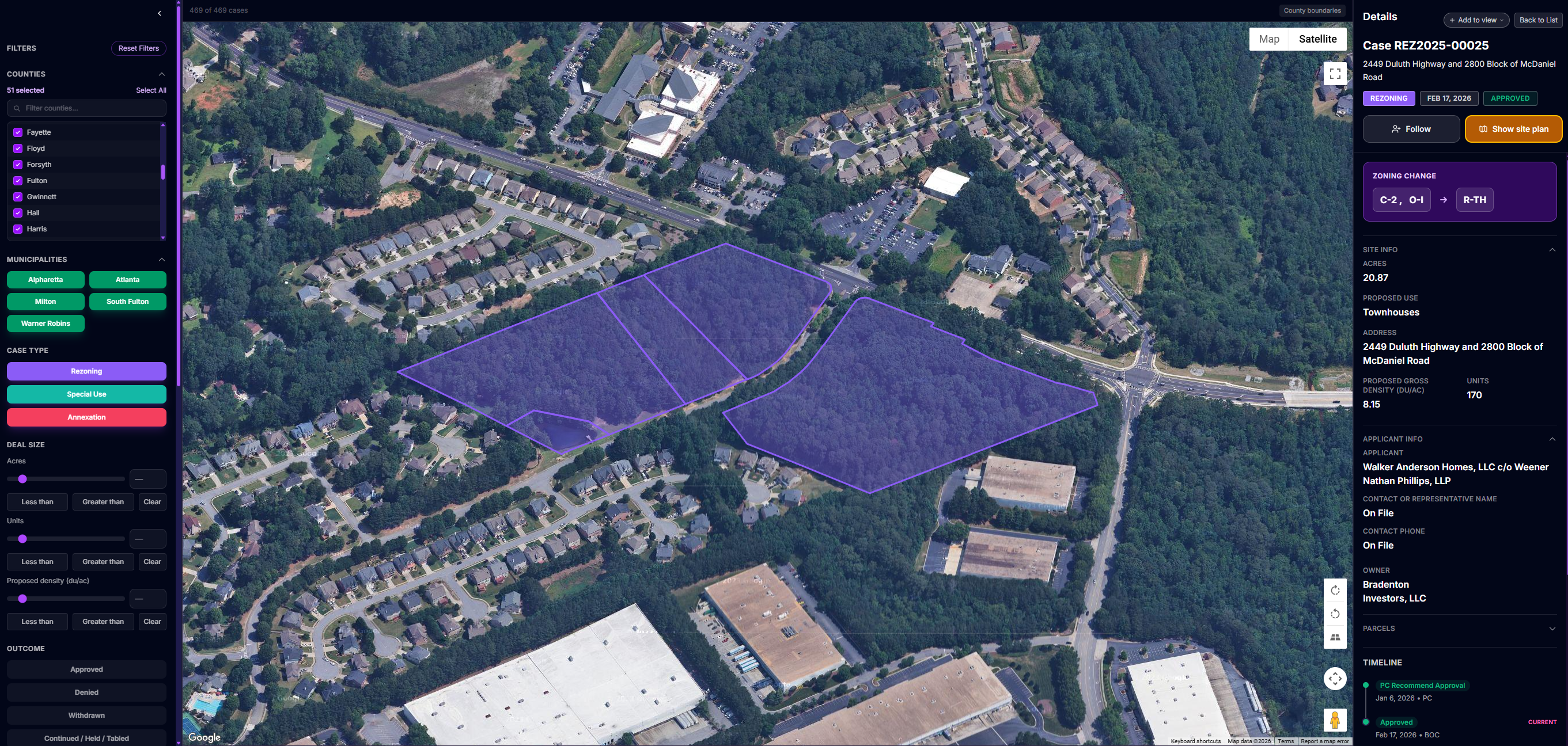
LandScout Map
From scattered county meetings to one statewide map
LandScout turns entitlement activity into something your team can actually work with.
Map-first intelligence
See rezonings, site plans, and related activity directly on the map instead of hunting through county agendas one by one.
Parcel context built in
Click from the opportunity into parcel-level detail, surrounding activity, and the source materials behind it.
Buy-box filtering
Filter by units, acreage, density, zoning change, and other criteria to narrow the map to what your team actually wants.
Workflow, not just a feed
Track opportunities, review them in list or map view, and keep the context intact as you move between counties, parcels, and cases.
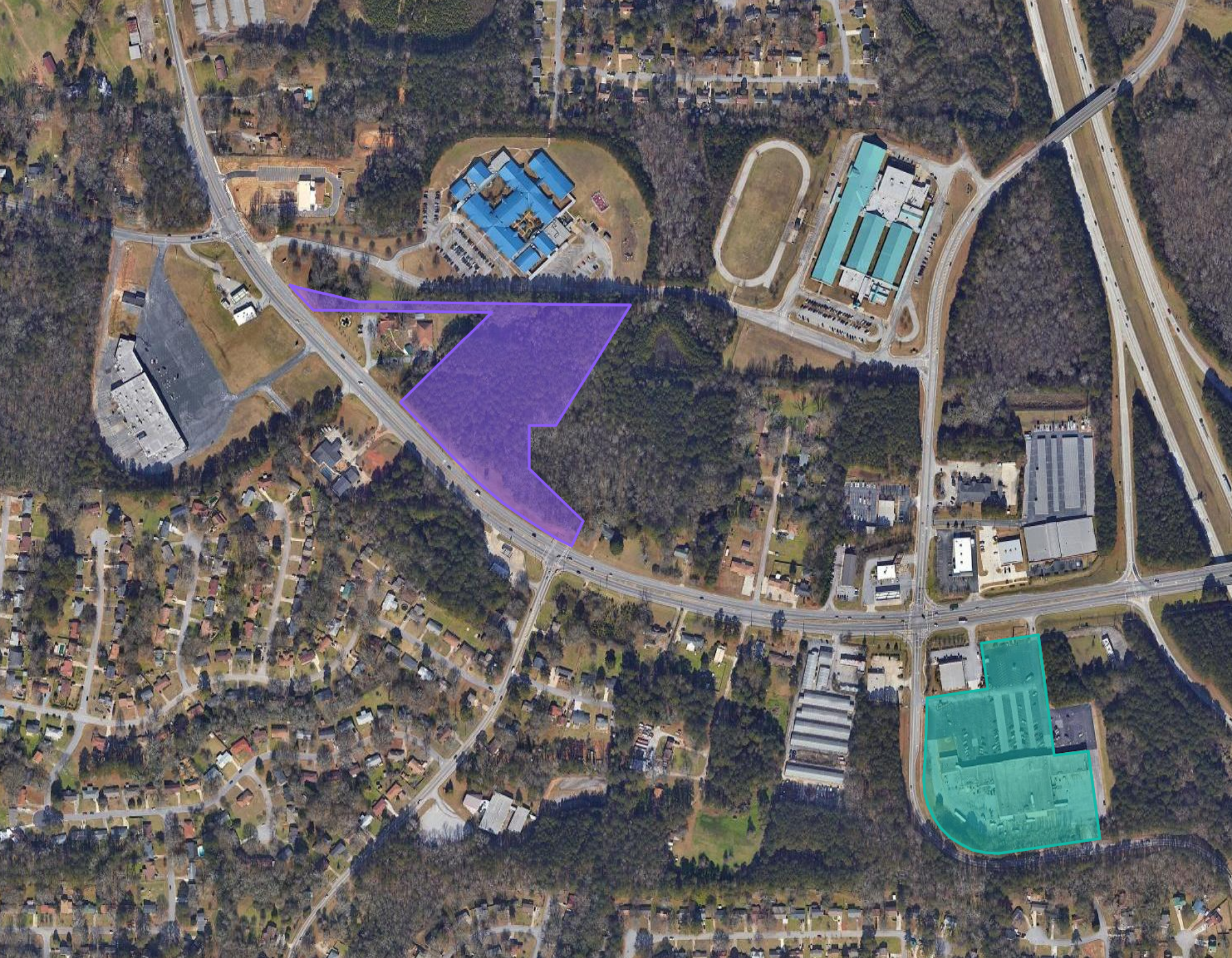
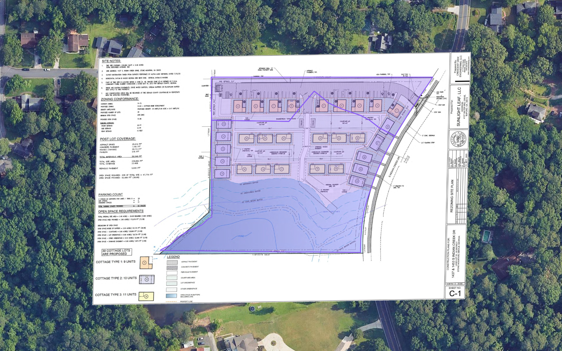
Site Plan Overlays
See how the site would really lay out
Do not stop at the agenda item or the PDF attachment. See the proposed development on the ground.
Site plans over real parcels
View buildings, drives, parking, setbacks, and layout against actual parcel geometry.
Understand the deal faster
Judge access, massing, frontage, and site use without manually stitching together multiple documents.
Skip the attachment hunt
Open the case, view the plan on the map, and keep moving instead of zooming around static sheets.
Same map, full context
Compare the plan with neighboring parcels, surrounding activity, zoning, and other live opportunities in one view.
Team Workflows
Track, share, and act on opportunities as a team
LandScout is not just a place to read about activity. It is a shared workflow for working live opportunities.
Save what matters
Add notes, tags, and internal context directly to the cases your team is watching.
Follow live activity
Get updates when a case moves boards, changes status, or hits an outcome that matters.
Assign next steps
Keep follow-up organized around hearings, site visits, and internal review.
Share the pipeline
Give your team one place to track active opportunities across counties, submarkets, and competitors.
Case Z-2024-045
ActiveNotes:
Next hearing scheduled Feb 14. Site visit scheduled.
Case Z-2024-045 moved to Planning Commission → Email sent to team
5 minutes ago
Know what you can build
Know what the entitlement could become
LandScout helps you understand not just that something is moving, but what can realistically be built there.
Key development limits
See lot size, density, height, setbacks, FAR, and other practical constraints in one place.
Normalized local rules
Read local zoning rules in a cleaner format without digging through county ordinances every time.
Faster first-pass underwriting
Get closer to “is this worth looking at?” without waiting on a full manual zoning deep dive.
Full Georgia Coverage
Statewide coverage changes the game
Most teams do not lose because they missed one hearing in one county. They lose because the signal was spread across places they were not watching closely enough.
LandScout tracks entitlement activity across the entire state, not just your core counties, so your team can see what is moving across Georgia in one system.
Built for teams sourcing across multiple counties.